STAY CONNECTED: Have the stories that matter most delivered every night to your email inbox. Subscribe to our daily local news wrap.
Outflows at Colliery Dam Park in Nanaimo have surged in recent weeks thanks to nearly non-stop rainfall. (Alex Rawnsley/NanaimoNewsNOW)
TRIFECTA

Nanaimo, Oceanside expecting glancing blow from storm parade’s third act

Nov 29, 2021 | 3:48 PM

NANAIMO — It won’t come with the same ferocity storms earlier in November delivered, but the region can still expect some sizeable rainfall coming.

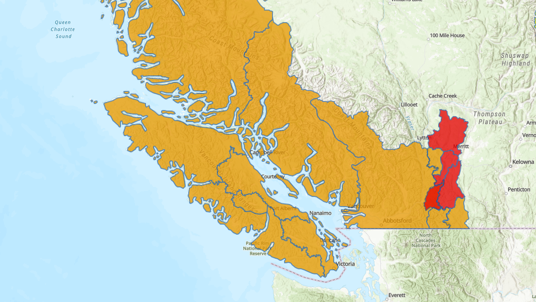
The third in a parade of storms, dubbed atmospheric rivers, is set to hit eastern Vancouver Island beginning Monday, Nov. 29 and extend through Wednesday, Dec. 1.

Geoff Coulson, a weather preparedness meteorologist with Environment Canada, told NanaimoNewsNOW the region can expect between 30 and 50 millimetres of rain during the storm, about the same volume which fell last weekend.

“Traditionally, the latter half of November and the first part of December is usually the wettest on Vancouver Island and coastal BC, but this series of storms is certainly adding to what’s already been a very wet fall across much of southwestern B.C. and Vancouver Island.”

Parts of northern Vancouver Island including Oceanside and the Comox Valley can expect similar amounts to Nanaimo, while Port Alberni is forecast to receive between 50 and 70 millimetres.

Data from Environment Canada shows 33.3 millimetres of rain fell at Nanaimo Airport on Saturday, Nov. 27. Specific tallies from Sunday weren’t available, however areas of the city itself saw considerably less rainfall than the day prior.

The system will hit B.C.’s north coast on Monday, triggering rainfall and winter storm warnings for areas around Haida Gwaii and Bella Coola.

It will move south, down the coast, with similar warnings in effect for western and northern sections of Vancouver Island.

Coulson did not expect rainfall warnings to be issued for eastern Vancouver Island, however suggested the danger in this storm is the fact its the third sizeable system within a week.

“When we look at the map from the River Forecast Centre, we continue to have a flood watch out for all of Vancouver Island, we know there’s sensitivities in some areas with rivers and streams running pretty high at this point.”

The River Forecast Centre has flood watches in effect for all of Vancouver Island, the B.C. coast and Lower Mainland. More severe warnings are in effect around Merritt. (BC River Forecast Centre)

Special weather statements were also posted for the inner south coast, including the Fraser Valley and for a section of east-central B.C. from the Shuswap to the B.C. boundary.

Forecasters said the storm there will start with snow and then switch to as much as 70 millimetres of rain, raising flooding risks.

Meanwhile the city of Sumas, WA, fired up its flood warning sirens again Monday morning as waters from rivers south of the border continued to rise.

A post on the City’s Facebook page said high water bypassed a bridge about half a kilometre south of the Canadian border and was spreading through the community.

Floodwaters from Washington state back up into low-lying areas of the Sumas Prairie on Abbotsford’s south side and have been blamed for flooding which devastated the agricultural area.

— with files from The Canadian Press

Join the conversation. Submit your letter to NanaimoNewsNOW and be included on The Water Cooler, our letters to the editor feature.

info@nanaimonewsnow.com

On Twitter: @NanaimoNewsNOW