LOCAL NEWS, DELIVERED DAILY. Subscribe to our daily news wrap and get the top stories sent straight to your inbox every evening.
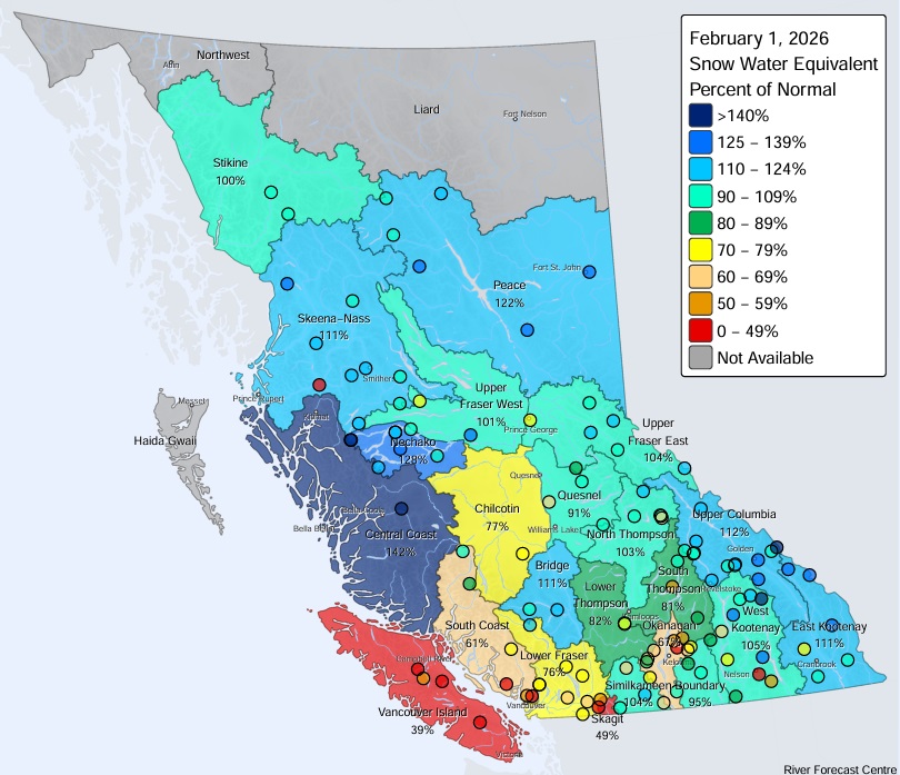
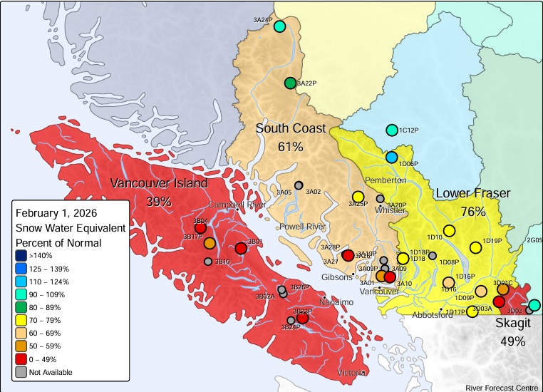
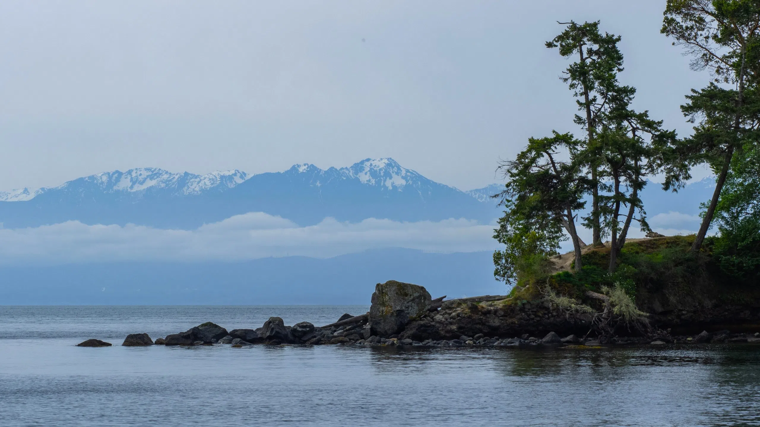
Snowpack levels across B.C. are about average, except on Vancouver Island, where only 39 per cent of mountain snow remains as of Feb. 1. (Image Credit: Dreamstime)
snowpack report

‘Not a good start:’ Vancouver Island lacking mountain snow

Feb 13, 2026 | 5:29 AM

NANAIMO — Mountain snowpack levels on Vancouver Island are currently the lowest in the province.

The Feb. 1 snow survey and water supply bulletin from the Ministry of Water, Land, and Resource Stewardship shows only 39 per cent of mountain snow remains on Vancouver Island, down 19 per cent from Jan. 1.

Last year at this time, 82 per cent of mountain snow was still present.

Province-wide, 96 per cent of the snowpack levels remain, down from 107 per cent on Jan. 1, but still considered in the normal range, and much higher than this time last year, when only 72 per cent remained.

Areas of northern and central B.C. still have the majority of their mountain snowpack as of Feb. 1.
Areas of northern and central B.C. still have the majority of their mountain snowpack as of Feb. 1. (Image Credit: B.C. River Forecast Centre)

In front of Vancouver Island is the Skagit watershed at 49 per cent, followed by the South Coast at 61 per cent, and the Okanagan at 67 per cent.

The majority of areas still have between 70 and 128 per cent of their snowpack levels.

The reports said typically, two-thirds of the annual snowpack has accumulated by Feb. 1, and areas with below normal snowpack show “early concerns for drought conditions amplifying in the spring and summer.”

While there is still time left in winter for more snow accumulation, the long-term forecast doesn’t look too promising, with the Vancouver Airport preparing for its first snow-free winter in over 40 years.

While the percentages vary, Vancouver Island is lacking in mountain snow for this time of year.
While the percentages vary, Vancouver Island is lacking in mountain snow for this time of year. (Image Credit: BC River Forecast Centre)

Meteorologist with Environment and Climate Change Canada Colin Fong, told NanaimoNewsNOW the second half of February will likely see temperatures return to normal after a warm start to the month, with several high-temperature records falling.

“We’re going to see maybe conditions start cooling off a little bit, but when I say cooling, it’s going to be more so heading towards normal of what we expect for this time of year, which is around daytime highs of say six degrees.”

Fong said while no temperature records were broken last month in Nanaimo, Jan. 12 was the second-warmest on record for the day at 12.2 degrees (Celsius), with the following day reaching 11.2 degrees, good enough for the four warmest in the City’s history.

Weather records date back to 1892.

Fong said as of now, there are no strong signals indicating cold Arctic air will be headed our way anytime soon, which normally brings flurries.

He said it’s been a “fairly warm winter” so far, in line with weather experts’ predictions, with Dec. 2025 the fifth warmest in Nanaimo’s history.

In January, the average temperature was 4.6 degrees, about a degree higher than average, with the month bookended by wet periods with a week-long dry stretch in the middle bringing fog warnings and advisories.

While snowpack levels aren’t his field of expertise, Fong said below-average levels at this time of year make meteorologists “perk up” and pay close attention to water levels during the winter months.

“It’s not a good start as we kind of head into that drought season later on into the summer months. And also, even in terms of wildfire as well, having drier snowpack doesn’t play well into that.”

The next snow conditions and water supply bulletin will be published on March 1.

We’re on Bluesky! Stay up to date on news across central Vancouver Island through Bluesky, by following @NanaimoNewsNOW.bsky.social.

info@nanaimonewsnow.com

Follow us on: Twitter (X) | Bluesky | Facebook