LOCAL NEWS, DELIVERED DAILY. Subscribe to our daily news wrap and get the top stories sent straight to your inbox every evening.
Strong winds coupled with a well-timed high tide, is causing the potential for coastal flooding around the Nanaimo region on Thursday. (Chad Hipolito/The Canadian Press)
potential flooding

High tide set to meet strong winds near Nanaimo on Thursday

Nov 5, 2025 | 4:00 PM

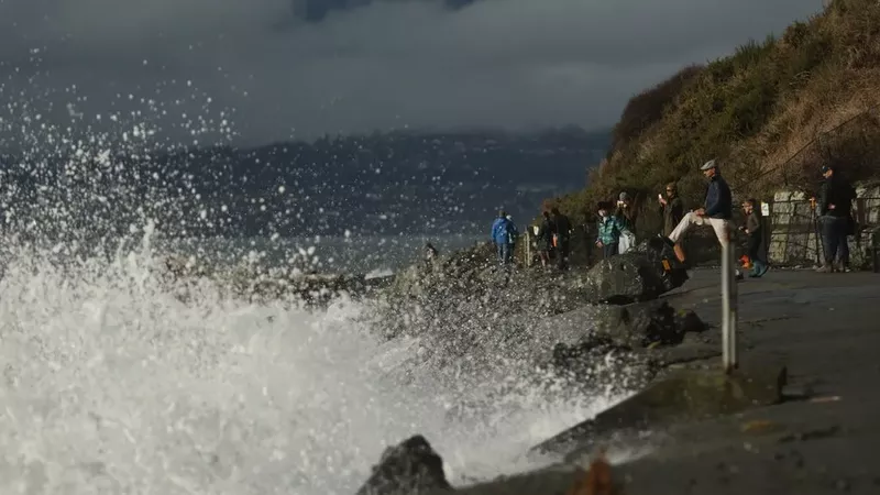
NANAIMO — Strong winds, coupled with a well-timed high tide, could cause some flooding issues.

Environment Canada issued a coastal flooding statement on Wednesday, Nov. 5 for the southern Gulf Islands, including Gabriola Island, and part of the southeastern Vancouver Island coast, advising of the potential for “higher than normal water levels.”

The advisory states elevated ocean waters, courtesy two high tides on Thursday, Nov. 6, are set to meet blustery winds from an ongoing Pacific storm system, along with another forecast right behind.

“Strong southeast winds will accompany both frontal systems. The timing of the peak southeast winds with high tide will result in potential storm surge with water level higher than the highest astronomical tide.”

The advisory does not extend to Protection Island or Saysutshun.

A high tide for Gabriola Island of 4.99 metres will peak at 6:47 a.m. on Thursday, followed by another high at 5:01 p.m. or 4.37 metres.

Nanaimo will see similarly timed tides at 4.6 metres and 4.4 metres.

Low tide is just before noon.

“Minor coastal flooding is likely along exposed shorelines, especially in the low-lying areas,” the statement continued. “Roads and walkways may be difficult to navigate due to flooding and/or debris, such as driftwood and rocks.”

Wind gusts upwards of 80 kilometres per hour are expected Thursday afternoon.

Local news. Delivered. Free. Subscribe to our daily news wrap and get our top local stories delivered to your email inbox every evening.

info@nanaimonewsnow.com

Follow us on: Twitter (X) | Bluesky | Facebook