LOCAL NEWS, DELIVERED DAILY. Subscribe to our daily news wrap and get the top stories sent straight to your inbox every evening.
A dump of snow and cold weather in early February helped add to the snowpack amounts in B.C.'s mountains, but levels are still around 25 per cent below normal province-wide at the start of March. (File Photo/NanaimoNewsNOW)
mountain snow

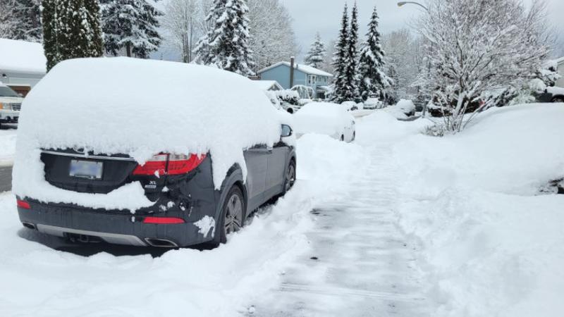
Island snowpack levels holding steady, still below normal

Mar 11, 2025 | 4:12 PM

NANAIMO — Cooler weather and a few rounds of precipitation in coastal areas were enough to keep B.C.’s snowpack level for March consistent with the previous month.

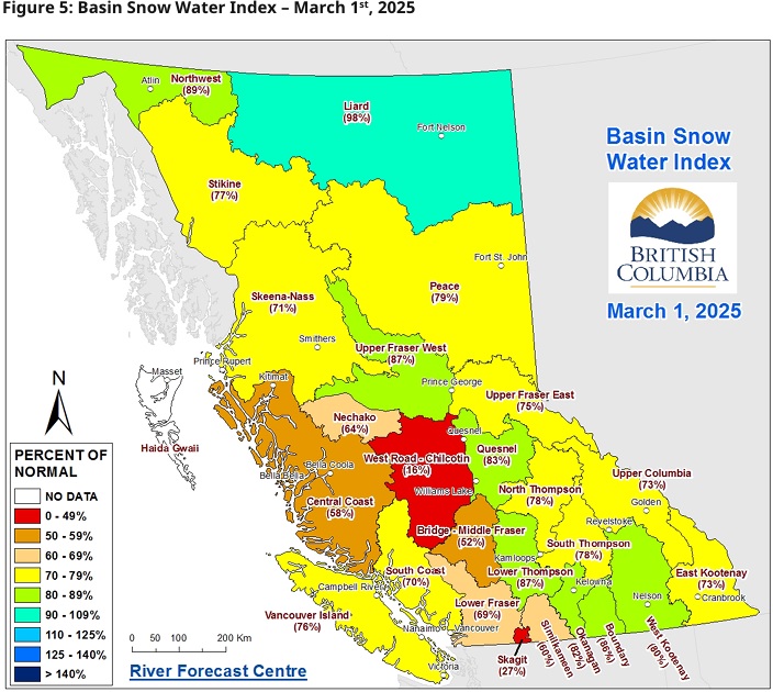
The March 1 snow survey and water supply bulletin provided by the Ministry of Water, Land and Resource Stewardship shows Vancouver Island snowpack levels at 76 per cent, a significant drop from 117 per cent of normal levels reported on Jan. 1, and down from 82 per cent from February.

Province-wide, snowpack levels are at 73 per cent of normal for March, up a single percentage point from February and down 14 per cent from January, but well above the B.C. average of 66 per cent from March 1, 2024, the second-lowest in provincial history.

The bulletin said while the lower-than-normal snow conditions reduce the chances of freshet flood hazards caused by heavy rain or melted snow, it also signals a chance of elevated drought hazards this upcoming spring and summer.

The basin snow water index for March 1, 2025, with Vancouver Island reporting 76 per cent of normal snowpack levels, an average number seen across the province, with Liard in the north with the highest at 98 per cent, and the Chilcotin region of the Fraiser Valley at only 16 per cent. (B.C. River Forecast Centre)

The report went on to say temperatures were below normal across the province last month, ranging from an average of -1.5 degrees Celsius to -6, with temperatures colder in the north but closer to seasonal in coastal areas.

Precipitation levels were also below normal province-wide, with a number of storms impacting mainly the southern regions near the end of the month, dumping snow in low-lying areas.

An atmospheric river storm in the first week of March also helped by adding large amounts of snow to the mountain regions, with the short-term forecast predicting more precipitation in the week to come.

The report said around 80 per cent of B.C.’s annual snowpack accumulates in early March, with four to eight weeks left in the snow accumulation season.

Current trends are expected to continue with a below normal snowpack year becoming increasingly likely, adding to persisting drought concerns impacted by previous drought seasons.

A La Nina climate pattern has been established in the Pacific Ocean, which historically has meant cooler and wetter conditions for coastal B.C.

The next snowpack and water supply report is due in early April.

Local news. Delivered. Free. Subscribe to our daily news wrap and get our top local stories delivered to your email inbox every evening.

info@nanaimonewsnow.com

Follow us on: Twitter (X) | Bluesky | Facebook