STAY CONNECTED: Have the stories that matter most delivered every night to your email inbox. Subscribe to our daily local news wrap.
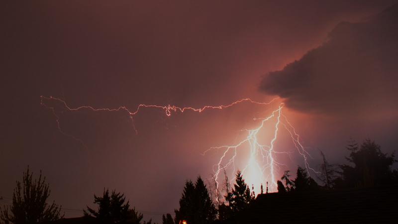
Lightning littered the skies above Nanaimo and the surrounding area on Sunday, Aug. 16 with several strikes reported. (submitted/Kam Abbott)
LIGHT SHOW

Hot, dry weekend sparks second lightning storm in as many weeks above Nanaimo skies

Aug 17, 2020 | 11:05 AM

NANAIMO — For the second time in as many weeks, the central Vancouver Island region has been centre stage for a significant thunderstorm.

Environment Canada said around 1,800 lightning strikes were recorded between southern Vancouver Island and the Sunshine Coast.

Meterologist Armel Castellan told NanaimoNewsNOW very little rain came with the lightning with a few, short showers recorded in the Nanaimo region.

“It really bubbled up at elevation and set off as soon as Vancouver Island was hit. As with these mid-elevation triggers, often it’s too dry and too hot in the lower regions and it evaporates the rain that usually comes with thunderstorm development.”

Lightning strikes were recorded on Vancouver Island beginning near Port Renfrew and tracking north-northeast past Nanaimo towards Powell River, then east towards Squamish and Whistler.

Sunday’s storm along with the light show over the August long weekend were anomalies for the region.

According to Environment Canada, Nanaimo records on average seven days of lightning strikes per year. Victoria sees 3.6 days, while the Comox Valley receives 5.6 days on average.

The storm has already triggered a couple of brush fires on the Island, west of Ladysmith and north of Lake Cowichan.

“We’ve got patrols standing by, helicopters checking them all out so we’ll be assessing and detecting for the next few days and dealing with any starts from the lightning storm,” Dorthe Jakobsen, fire information officer said.

A third fire along Hwy. 1 near Ladysmith was reported prior to Sunday’s storm and is being dealt with by local crews in Ladysmith.

The Green Mountain fire, which was triggered by lightning over the August long weekend is now considered under control after burning 16.9 hectares of land southwest of Nanaimo.

Sunday was also the third hottest Aug. 16 on record, reaching 32.8 degrees at Nanaimo airport.

The mercury fell just short of the 34.5 degree record set in 1977 although several temperature records were set on the mainland and Interior.

Temperatures are expected to remain high through Monday and Tuesday before a mid-week shift brings rain and cooler temperatures.

info@nanaimonewsnow.com

On Twitter: @NanaimoNewsNOW