STAY CONNECTED: Have the stories that matter most delivered every night to your email inbox. Subscribe to our daily local news wrap.
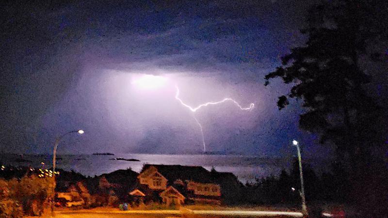
A view from north Nanaimo where Lightning strikes could be seen consistently shooting from overhead clouds during the early morning hours of Friday, July 31. (submitted/@JeffBlois)
BOOM, BANG, CRASH

Nanaimo, eastern Vancouver Island dazzled by overnight lightning show

Jul 31, 2020 | 9:32 AM

NANAIMO — Early risers or light sleepers were treated to a special show overnight.

The summer’s first major thunderstorm saw hundreds of lightning strikes occur over a five hour period, beginning around midnight on Friday, July 31, according to Environment Canada.

Meteorologist Carmen Hartt told NanaimoNewsNOW all the ingredients were in place for the year’s first major storm.

“(Thursday) was the hottest day we’ve had so far in 2020 with a high of 33.4 degrees and the dew point was really high so we had some moisture kicking around,” Hartt said.

“Whenever we have these heat events, they often end in thunderstorm outbreaks…you can almost feel it in the air, that energy in the air.”

Lightning stretched from the Campbell River area to west of the Cowichan Valley. Some rain fell as a result of the storm, however the Coastal Fire Centre had not reported any new fires as of Friday morning.

Hartt said the same unstable air which provided last night’s light show remains in the region on Friday with a continued chance for thunderstorm activity.

Environment Canada predicts the instability to move out of the mid island area by Saturday before a new system with showers is expected to blanket much of the region on Sunday.

“It’s not going to be rain through the whole day, just due to the nature of this system it’s more likely to be scattered showers,” Hartt said.

Temperatures are also expected to cool off into the mid-20s during the long weekend.

info@nanaimonewsnow.com

On Twitter: @NanaimoNewsNOW