STAY CONNECTED: Have the stories that matter most delivered every night to your email inbox. Subscribe to our daily local news wrap.

Nanaimo crews preparing for fallout, ferries suspended, as ex-typhoon hits south coast

Oct 15, 2016 | 11:38 AM

NANAIMO — While Environment Canada is predicting the mid-island won’t see the worst of a third consecutive storm bearing down on the South Coast, conditions are still expected to be wild.

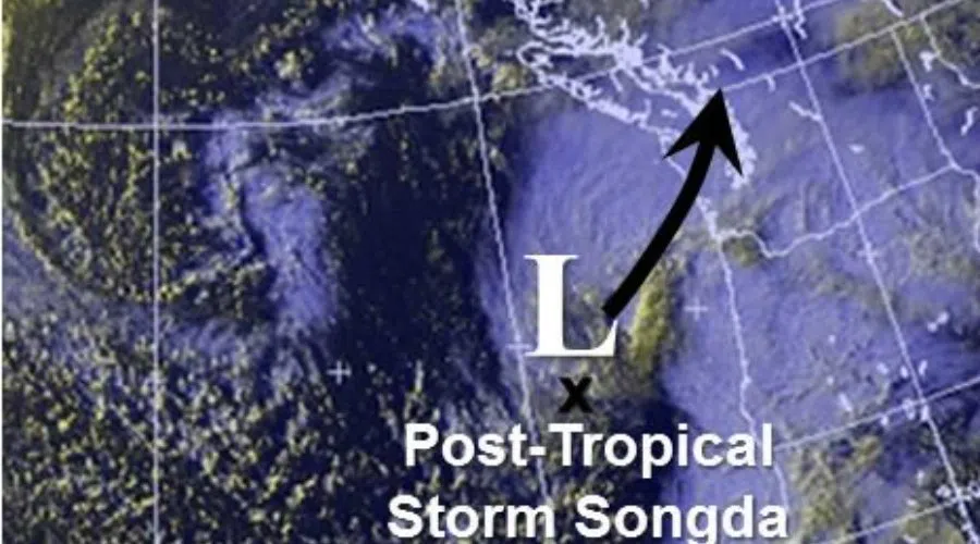
Wind and rainfall warnings are in effect for east Vancouver Island as the remnants of Typhoon Songda are expected to make landfall late this afternoon and into the night. The federal weather agency is calling for strong southeast winds of 60 to 100 km/h. That will be accompanied by heavy rain, according to the weather statement.

“Anywhere upwards of 40 to 60 mm of rain and it should be in a fairly short time period because this storm has a tropical characteristic to it from the ex-typhoon,” says meteorologist Matt Loney. “It does have some intense rainfall rates associated with it so we could see some decent rainfall rates in a short period of time later this afternoon and this evening.”

Loney says the mid-island region will likely miss the most extreme of the storm conditions.

“Right now the latest that we have on path looks like it’s going to be maybe just hitting the tip of the Olympic Peninsula (south of Victoria) and then across the southern part of Vancouver Island towards the Sunshine Coast.”

Since late Wednesday B.C.’s South Coast has been hammered by back-to-back storms bringing heavy rain and winds. BC Hydro has been dealing with thousands of outages. At one point Friday more than 40,000 homes on the island and Lower Mainland were without power. Nanaimo has escaped the majority of those issues however. BC Ferries were also thrown off course on Friday as several sailings between Nanaimo and the mainland were cancelled or delayed.

BC Ferries’ executive director of public affairs Deborah Marshall says they will be suspending service on all of their major routes between the Lower Mainland and the Gulf Islands as of 3 p.m. Saturday. That will include the Departure Bay-Horseshoe Bay route and the Duke Point-Tsawwassen route. Marshall says they expect service to resume first thing Sunday morning. She says they will begin service out of Duke Point at 5:15 a.m., weather permitting.

Nanaimo’s emergency program manager Karen Lindsay says city crews are preparing for heavy sustained winds for “quite a period of time”. She says it’s important for people to remember to only call 911 if there is a safety emergency so the lines don’t get tied up. For any power outages, she says, call BC Hydro. Lindsay says if people need sandbags they can get them for free at the Public Works yard on Labieux Road. Bags and sand are available and people need to bring their own shovels.

Another important thing people need to do is make sure they remove any loose items from their yards or patios, Lindsay says.

Environment Canada’s weather statement says the winds should begin to ease by early Sunday morning.

Continue to follow NanaimoNewsNOW on Twitter and Facebook for updates on things like hydro outages, ferry cancellations and information from the city of Nanaimo.