LOCAL NEWS, DELIVERED DAILY. Subscribe to our daily news wrap and get the top stories sent straight to your inbox every evening.
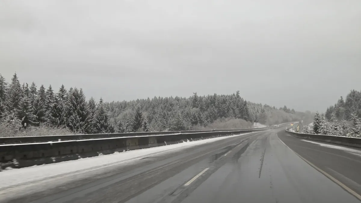
Snowpack levels on Vancouver Island's mountains remain at the lowest levels in the province. (Image Credit: Ian Holmes/NanaimoNewsNOW)
dry winter

Mountain snowpack levels increase on Vancouver Island, but still lowest in the province

Mar 11, 2026 | 4:11 PM

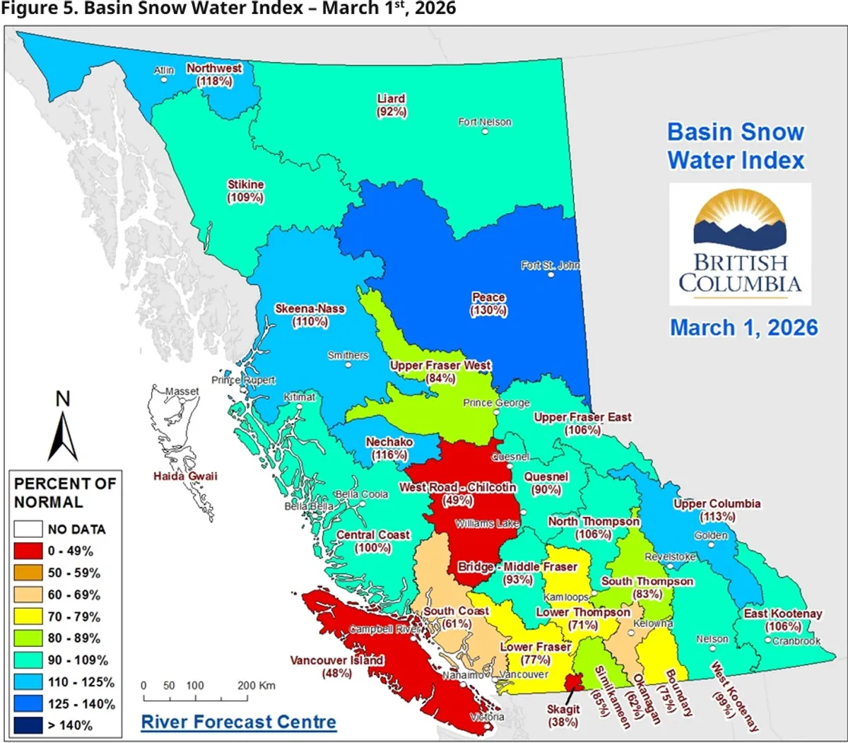
NANAIMO — A bit more snow fell on Vancouver Island’s mountains last month, but our snowpack levels are still the lowest in the province.

As of March 1, 48 per cent of the average levels of snow remain, a nine per cent increase from February, but down from 58 per cent in January, according to the latest report from the Ministry of Water, Land, and Resource Stewardship.

It’s a stark contrast from the same time in 2025, when 76 per cent of Vancouver Island’s mountain snow remained, as Nanaimo emerges from one of the warmest winters on record.

Province-wide, 91 per cent of mountain snow remains1, down from 96 per cent in February, but much higher than this time last year, when 73 per cent remained.

Monitoring stations in the northern half of the province are reporting average or near-average levels of mountain snow, while the southern and coastal parts of B.C. are generally below average.

Below-average snowpack levels across the province increase drought concerns, as a weather system brings lower temperatures and more precipitation during the second week of March.
Below-average snowpack levels across the province increase drought concerns, as a weather system brings lower temperatures and more precipitation during the second week of March. (Image Credit: B.C. River Forecast Centre)

The first part of February remained relatively dry, despite several storm systems moving across the province.

The second half of the month brought cooler weather patterns and moderate precipitation to some areas, adding to the mountain snow levels, according to the report.

While there are still four to eight weeks remaining in the snowpack accumulation season, areas with below normal levels are at increased risk of drought conditions, which could be amplified in the spring and summer months.

The report said by March 1, around 80 per cent of B.C.’s annual mountain snowpack has accumulated, however, that doesn’t mean the mid-Island is done with snow quite yet.

Below-zero overnight temperatures brought snow to higher elevations on the Island on Monday, March 9, and continued into Tuesday, causing slow and hazardous conditions.

Snow was falling inside Nanaimo city limits, but was quickly melting, while areas of higher elevation north and south of the city saw a few inches of the white stuff come down.

Snow was falling north of Qualicum Beach during the morning of Tuesday, March 10, with special weather statements in place warning of snow accumulation in place for much of Vancouver Island.
Snow was falling north of Qualicum Beach during the morning of Tuesday, March 10, with special weather statements in place warning of snow accumulation in place for much of Vancouver Island. (Image Credit: Submited photo)

With files from The Canadian Press.

Local news. Delivered. Free. Subscribe to our daily news wrap and get our top local stories delivered to your email inbox every evening.

info@nanaimonewsnow.com

Follow us on: Twitter (X) | Bluesky | Facebook