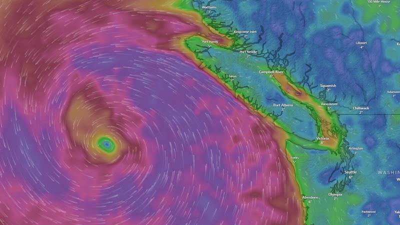
Strong winds are brewing off the coast of Vancouver Island, however impacts in the Nanaimo region are not expected to be severe. (Windy.com)
fall storm

Nanaimo & Oceanside not expected to feel full effects of ‘bomb cyclone’ hitting B.C.

Nov 18, 2024 | 10:15 AM

NANAIMO — Despite forecasts predicting a “bomb cyclone” moving through coastal B.C. mid-week, one Environment Canada meteorologist doesn’t forsee any major issues locally.

Brian Proctor said a “very significant” low pressure system is swirling in the Pacific, with strong winds and heavy rain forecast for areas south of B.C. and the western side of Vancouver Island beginning Tuesday, Nov. 19 and continuing into Wednesday.

But parts of eastern Vancouver Island, ranging from Ladysmith to Campbell River, should only expect between 10 to 20 millimetres of rain, coupled with some moderately strong wind gusts.

“The biggest winds are going to be coming out of the coastal inlets, areas that are downstream of some of those northwest-southeast inlets will pick up more wind and probably areas like Vancouver with the east-west orientation of the Fraser Valley will produce some more wind as well.”

Wind gusts for both Nanaimo and Parksville are forecast to peak around 60 to 70 kilometres per hour, with more sustained winds between 20 and 40 kilometres per hour.

Mountains down the spine of Vancouver Island will play a big role in this storm, with substantially more impacts on the western side than the east.

Regardless, Proctor said there may be some adverse affects for mid-Island residents in the form of power outages and ferry cancellations.

“People should be prepared for some wind impacts, we may see some local power outages, I don’t think they’ll be particularly widespread with this kind of event…and those outages may be a bit longer duration associated with some of the areas seeing winds.”

While the term ‘bomb cyclone’ might sound ominous, it’s a well-worn meteorological term dating back to the 1980’s.

It’s used to describe a specific type of storm, common in the late fall and early winter, where the pressure in its centre drops 24 millibars or more in 24 hours.

The lower the pressure, the more ferocious a storm.

“This is looking a little more intense, it’ll probably deepen more than that 24, maybe closer to 36 or 48 millibars in that 24 hour period, still a very intense storm,” Proctor said. “It’s really largely due to an injection of cold air into the backside of low pressure areas, which really helps intensify the circulation around that low pressure centre itself.”

Local news. Delivered. Free. Subscribe to our daily news wrap and get our top local stories delivered to your email inbox every evening

info@nanaimonewsnow.com

On Twitter: @NanaimoNewsNOW