Minor boundary change supported by Regional District of Nanaimo board
-
Share on Facebook
-
Share on Bluesky
-
Share on X
- Copy Link
NANAIMO — Neighbourhood geography has triumphed over lines on a map for 16 properties south of the city.
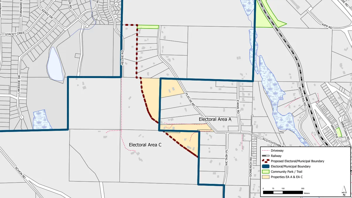
The Regional District of Nanaimo Board gave its unanimous approval on Tuesday, March 24, to a boundary realignment between Areas A and C, mainly affecting a row of properties on Plecas Rd., just west of the Duke Point Hwy. interchange on the Trans Canada Hwy.
Currently situated in Area C, an expansive boundary which encompasses Extension, Cassidy, and rural areas to the west of Nanaimo, the move to Area A (Cedar, Yellow Point) is one which makes sense in practical terms.
“Those sixteen properties exist on a ridge that is connected to Area C, but it is not connected by a road to the rest of Area C at all,” Lauren Melanson, Area C director, said. “You have to travel through Area A to get to the rest of Area C. There’s no way to get to that portion of Area C, without going through Area A, it makes absolutely no sense.”