LOCAL NEWS, DELIVERED DAILY. Subscribe to our daily news wrap and get the top stories sent straight to your inbox every evening.
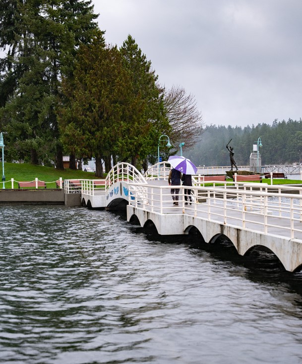
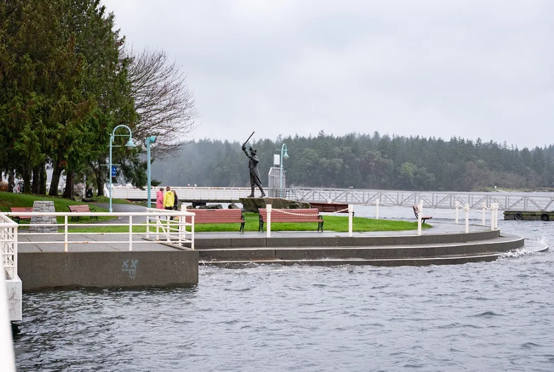
A King tide inches to within feet of Nanaimo's iconic Frank Ney statue. (Image Credit: City of Nanaimo)
climate change

‘To make sure that we’re adaptable’ Nanaimo updating sea level rise planning

Feb 24, 2026 | 5:37 AM

NANAIMO  — Additional work is being done by the City of Nanaimo to more clearly define potential dangers posed by rising sea levels.

A 2018 study predicted sea levels would rise by 0.88 meters by the year 2100 in Nanaimo, which also flagged four particularly vulnerable areas: downtown, Protection Island, Duke Point and Departure Bay.

Dave Stewart, environmental planner for the City of Nanaimo, said the 2018 study was a “worst case scenario” of negative impacts coinciding at the same time: rising sea, storms and high tide.

“What we’re doing now with the current work is we’re doing what’s called a probability analysis, which is basically a more realistic way of looking at what actually might happen here.”

A King tide filing into Maffeo Sutton Park's Swy-a-Lana Lagoon
A King tide filing into Maffeo Sutton Park’s Swy-a-Lana Lagoon (Image Credit: City of Nanaimo)

Stewart said the 2018 study by a consultant recommended the City embark on re-mapping flood lines in the four most at-risk areas.

Re-mapping provides a key plank in the Sea Level Rise Management Plan, while the other primary factor is determining how to react, Stewart said.

Determining the economic risk of rising ocean levels can’t be ignored, he emphasized.

A pair of surveys, including one online available until March 13, are important aspects of the updated plan, Stewart said.

“It’s going to help us then have a conversation with the public, with other experts and stakeholders about what we do about it, how we’re going to protect our coastline,” Stewart told NanaimoNewsNOW. 

Evidence of rising sea level is already impacting Nanaimo, Stewart noted.

He pointed to cases of particularly potent king tides encroaching on city parks and private properties.

Visible signs of bank erosion in the Invermere Beach area beneath Icarus Dr. In north Nanaimo requires further monitoring and likely intervention in some form, Steward said.

As for potential responses to rising ocean levels locally, Stewart said a potential option is a creative example deployed in Qualicum Beach called Green Shores, involving more natural solutions .

A spit created by piles of large rocks was formed along Qualicum Beach’s waterfront several years ago.

“Rather than building a hardened seawall, it’s mimicking the natural shoreline and essentially sloping it up so that the wave action dissipates as it goes and using natural barriers,” Stewart said.

He noted future land use policy could involve withholding new development from risk zones, or requiring more resilient construction tactics.

A fierce storm batters driftwood up against the beach front at Pipers Lagoon Park.
A fierce storm batters driftwood up against the beach front at Pipers Lagoon Park. (Image Credit: File photo/NanaimoNewsNOW)

Acknowledging climate change centres around evolving science, Stewart said their new sea level rise guiding document won’t restrict the City’s ability to change course.

“To make sure that we’re adaptable in our choices and that our decisions that we make now can be resilient to future changes.”

Stewart expects the newly formed plan to be formally adopted by this summer.

Nanaimo’s Sea Level Rise Management Plan project was funded by grants from the provincial Ministry of Emergency Management and Climate Readiness, and Federation of Canadian Municipalities.

Follow us on Facebook. Join Everything Nanaimo on Facebook and stay connected with everything happening on central Vancouver Island.

info@nanaimonewsnow.com

Follow us on: Twitter (X) | Bluesky | Facebook