STAY CONNECTED: Have the stories that matter most delivered every night to your email inbox. Subscribe to our daily local news wrap.
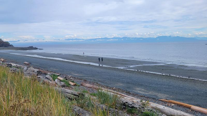
An average August weather-wise capped off a very seasonal summer for much of Vancouver Island, with enough rain falling to dampen any serious wildfire concerns. (Jordan Davidson/NanaimoNewsNOW)
average august

Average August continues seasonal summer weather trend for Nanaimo

Sep 4, 2024 | 5:29 AM

NANAIMO — An average August weather-wise capped off a fairly average summer in the sun for much of eastern Vancouver Island.

The mean temperature throughout August was 18.6 degrees Celcius in Nanaimo, only about half a degree above average.

Meteorologist with Environment and Climate Change Canada Brian Proctor told NanaimoNewsNOW despite some long stretches of hot weather, enough rain fell to cool things off.

“Total precipitation was 37.8 millimetres recorded versus a normal of 28.4. So a bit wetter than normal, about 133 per cent of normal precipitation reported in the Nanaimo area.”

Moving north up island, Proctor said the Comox Valley/Courtenay area had an average temperature of 18.9 degrees, one degree above average.

However, precipitation levels varied from one community to the next, with Comox seeing 77 per cent of their normal rainfall with 22.6 millimetres, whereas Campbell River had 111 per cent of their regular rainfall with 49.6 millimetres.

While there wasn’t enough rain to make a substantial dent in the ongoing drought concerns province-wide, Proctor said it did help tone down the island’s forest fire risk.

“But it didn’t really do enough to put a dent in the long-term drought conditions. We really do need that early-fall precipitation to really help us at this point in time, to make a bigger dent in the long-duration drought we’ve been experiencing.”

Summer
Environment Canada predicted a cool start to summer followed by above-normal temperatures for most of B.C., while predictions for the coastal areas of the province indicated an average summer for heat and rain.

When looking at June, July, and August as a whole, Proctor said Nanaimo was only a half a degree above normal temperature-wise, coming in at 17.9 degrees, with the amount of precipitation also right about average.

“I think what really happened is the earlier part of the summer was warmer than normal and it sort of trended towards little bit cooler conditions… it didn’t come in until we got more into August. The models may have been a little bit too quick in trying to cool things off.”

Looking ahead to the rest of September and into the fall, he said there’s not much indication of any intense precipitation events heading our way.

September is traditionally one of the drier months for Vancouver Island.

“We’re looking at a developing La Nina this fall and winter, but it’s been a little slower to develop than was initially considered. So I think we’re looking at fairly normal conditions as we move into the start of fall. Probably more towards the end of October/November before we start seeing more typical fall-like conditions and see that enhanced precipitation that we really need.”

Join the conversation. Submit your letter to NanaimoNewsNOW and be included on The Water Cooler, our letters to the editor feature.

jordan@nanaimonewsnow.com

On Twitter: @JordanDHeyNOW