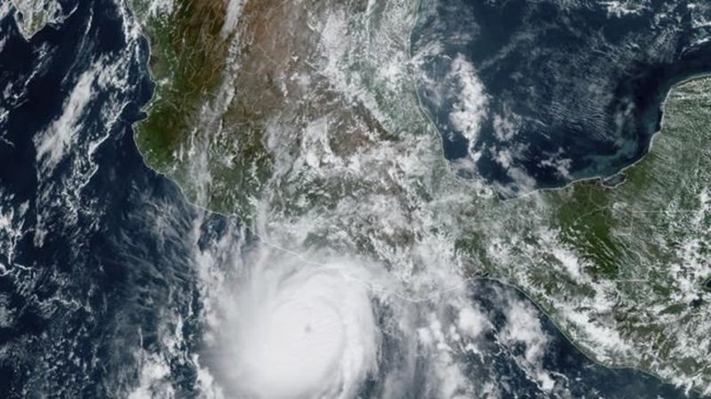
Hurricane Otis rapidly grows into Category 4 storm off Mexico’s Pacific coast heading for Acapulco

Oct 24, 2023 | 5:30 PM

ACAPULCO, Mexico (AP) — Hurricane Otis strengthened from a tropical storm to a dangerous Category 4 hurricane in a matter of hours Tuesday as it approached Mexico’s southern Pacific coast, where it was forecast to make landfall near the resort of Acapulco early Wednesday possibly as a catastrophic Category 5 storm.

The U.S. National Hurricane Center said Otis has maximum sustained winds of 145 mph (230 kph) early Tuesday evening. It was centered about 85 miles (135 kilometers) south-southeast of Acapulco and moving north-northwest at 8 mph (13 kph).

The center warned that Otis would continue strengthening and could become a Category 5 hurricane with top winds above 157 mph (253 kph) before making landfall. A hurricane warning was in effect from Punta Maldonado to Zihuatanejo.

In Acapulco, people hurried home as rain began to pelt the resort and winds picked up, driving tourists from the beach.

The Guerrero state government said it was preparing 396 shelters in anticipation of families being driven from their homes by wind damage or surging waters.

Mexico’s army and navy deployed more than 8,000 troops to the area with specialized equipment to aid in rescues. Authorities closed Acapulco’s port, home to some 300 fishing boats.

Otis was expected to dump five to 10 inches of rain on Guerrero, with as much as 15 inches possible in some areas. That raised the possibility of mudslides in Guerrero’s steep mountainous terrain.

In the Atlantic, Hurricane Tammy continued moving northeastward over open water with winds of 75 mph (120 kph) after sweeping through the Lesser Antilles over the weekend. Tammy was located about 565 miles (910 kilometers) south-southeast of Bermuda. The storm was expected to weaken by Thursday, according to the U.S. National Hurricane Center.

____

Follow AP’s climate coverage at: https://apnews.com/hub/climate-and-environment

José Antonio Rivera, The Associated Press