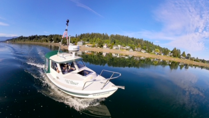
Wilbur made the long trek from Nanoose Bay to Comox recently, mapping and photographing the shoreline for future study, comparison and planning. (Pacific Salmon Foundation)
SEA LEVEL RISE

Small boat mapping ‘coastal squeeze’ and shore line of central Vancouver Island

Jul 18, 2023 | 4:27 PM

NANAIMO — A small boat named Wilbur, and its crew, are having a big impact on how Island communities grow.

The 16-foot vessel has been making its way up the coast of eastern Vancouver Island, on a five year tour to better map, photograph and otherwise document the landscape.

Kyla Sheehan, project manager for the Resilient Coasts for Salmon Project through the Pacific Salmon Foundation, told NanaimoNewsNOW they’re trying to raise awareness around climate change and its impacts locally.

“Our goal is to have a really valuable data set of this imagery that we can use to help inform decision-making around coastal development and planning and communities for the communities sake, for housing security, housing security as well as…preserving valuable habitat for species on our coast.”

Wilbur comes equipped with two cameras, one which takes 360-degree video and a second which snaps high-resolution images of the coastline every three seconds.

It travelled from Schooner Cove in Nanoose Bay to the Comox Valley last weekend.

Previous trips over recent months ventured from Victoria to Nanaimo.

“Showing exactly where along the coast is modified with structures like sea walls, groynes, ripraps, docks as well as log accumulation. What we’re doing by reviewing the imagery is really taking a look at what structures are on the shoreline and how they’re going to interact with coastal processes.”

Interruption of those processes can have potentially devastating effects.

Sheehan said letting nature do its thing helps preserve species and ecological health in the area.

“In a lot of areas we’ve built right up to the shoreline and that’s a process called ‘coastal squeeze’ when we build…these hard structures that basically cut off any coastal processes and remove the ability of the shoreline to adapt to changing conditions.”

Cameras on board capture images of the shoreline which are then combined with other data sets to get a comprehensive look at the area. (Pacific Salmon Foundation)

Wilbur’s venture is the first project of its kind for the Pacific Salmon Foundation, however other surveys of coastal areas are on record.

Shore Zone involved aerial images being captured from Alaska to Oregon in the 1980’s. The current survey not only provides an updated look at the area, but also close-up images during high tide of the coastline and its features.

Sheehan said information will be processed, combined with over 450 other data sets to create a comprehensive reference guide for all to use.

“We’re trying to deliver really science-based information to help guide, informed decision-making and policy creation in some areas. You can layer things like the shoreline modification layer with something like a projected sea level rise in 2100…that helps you see the interactions and make connections to why this stuff matters.”

She added planning for documented and projected sea level rise is crucial for coastal communities.

The five year project will last until 2026 and is due to provide an incredibly detailed look at coastal Vancouver Island. (Pacific Salmon Foundation)

Local news. Delivered. Free. Subscribe to our daily news wrap and get our top local stories delivered to your email inbox every evening

info@nanaimonewsnow.com

On Twitter: @NanaimonewsNOW