STAY CONNECTED: Have the stories that matter most delivered every night to your email inbox. Subscribe to our daily local news wrap.
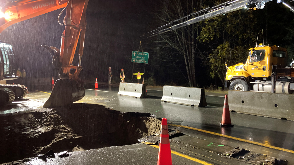
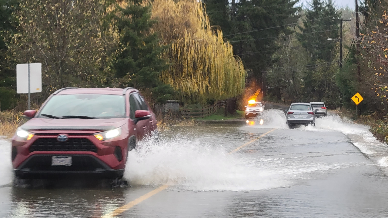
From puddles to mud slides, sinkholes and localized flooding, an already weather-battered region is in line for more heavy rainfall in the coming week. (Alex Rawnsley/NanaimoNewsNOW)
HEAVY RAINS

‘Let’s be ready for this:’ meteorologists eye trio of storms bringing next deluge to central Island

Nov 23, 2021 | 11:57 AM

NANAIMO — Less than two weeks after a parade of storms caused widespread flooding and damage across southern B.C., another round is slated to pass through.

Environment Canada is tracking three storms forecast to hit B.C.’s coast over the next seven to nine days, beginning Wednesday, Nov. 24.

Meteorologist Doug Lundquist told NanaimoNewsNOW around 40 to 50 millimetres of rain is expected from two storms between Wednesday and the weekend, however a weather system further out has Lundquist “really concerned.”

“When I look at our guidance that goes out that far, it has way more moisture than the first two. It has moisture signature that’s more like the subtropics than you would typically see here.”

Following an initial hit on Wednesday and Thursday, Nov. 25, the region will see a small break before a second storm over the weekend. A third one is forecast near the end of the start of December.

Early models suggest Nanaimo and parts of the central Island could see upwards of 120 millimetres of rain between Nov. 25 and Dec. 1, although Lundquist conceded the storm is still too far out to tell where it will hit hardest.

The systems are already causing issues in Nanaimo, with Saturday’s planned Santa Claus parade through the downtown cancelled in large part due to the weather.

Crews worked through the night on Thursday Nov. 18 and Friday, Nov. 19 to dig out and stabilize a sink hole on Hwy. 19. (submitted photos)

Nanaimo Airport recorded 142.1 millimetres of rain between Nov. 13 and 15, leading to the collapse of a section of Hwy. 19 north of Nanaimo.

A monitoring station at Qualicum Beach Airport measured 91.8 millimetres over the same three days.

Lundquist said the messaging now from local and provincial governments centres around preparation.

“Let’s just prepare for a really nasty, stormy pattern and hope it heads off shore or somewhere between cities where not too many people live, but let’s be ready for this. Let’s be prepared with the sandbags and the responders just to try and protect things if things get nasty.”

Forecasting for the storm next week has its current track hitting the northern part of Vancouver Island, Sunshine Coast and areas around Bella Coola.

Lundquist said further analysis in the days to come will clarify the storm’s strength and path.

Water breached several area roads, including washouts on Nanaimo’s Bruce Ave. during rainfall between Nov. 13 and 15. (Alex Rawnsley/NanaimoNewsNOW)

A warming trend through the remainder of this week will see some recent high-elevation snowfalls melt, further contributing to already saturated soils.

“It is that storm after storm after storm, relentlessly fills the rivers up. They fall but they can’t quite get back to where they need to be and the soils don’t completely percolate out and bam there’s another storm.”

Lundquist likened this year’s storm setup to 1990 when extensive rain lashed B.C.’s coast. Nanaimo recorded 320.1 millimetres of rain in November of that year.

As of Nov. 21, the airport monitoring station recorded 296.1 millimetres of rain this month.

Join the conversation. Submit your letter to NanaimoNewsNOW and be included on The Water Cooler, our letters to the editor feature.

alex@nanaimonewsnow.com

On Twitter: @alexrawnsley