STAY CONNECTED: Have the stories that matter most delivered every night to your email inbox. Subscribe to our daily local news wrap.

‘Parade of storms’ to continue to lash Nanaimo region into next week: Environment Canada

Dec 14, 2018 | 4:49 PM

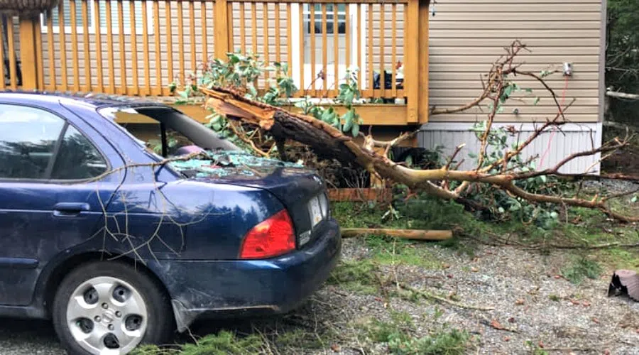
NANAIMO — While many Nanaimo residents are still picking up the pieces from Friday’s intense wind storm, Mother Nature’s onslaught on the east coast of Vancouver Island isn’t over yet.

Environment Canada meteorologist Armel Castellan told NanaimoNewsNOW another storm will hit the region late Saturday night into Sunday morning, the first of at least three more systems on the way by the middle of next week.

Castellan said since a stagnant system moved out of the region around Dec. 9, the pacific storms have moved in.

“It’s a parade of storms. They’re very progressive and moving quickly, hence the big winds associated to it. It has been wet and we’ll see some notable rain coming up.”

He said Saturday and Sunday’s storm will bring slightly slower wind speeds than Friday afternoon, but much more rain. He said there could be anywhere from 50 to 60 millimeters throughout the day Sunday and even more in the mountains.

“Flooding, power outages, ferry cancellations are all definitely very much possible,” Castellan said. “It is certainly a marked event we have concerns about.”

A shorter but also intense rain event is expected on Monday afternoon, followed by a soaking system through Wednesday and Thursday of next week, Castellan said.

One positive, Castellan said, is that the only snow predicted to fall will be at significant elevations.

There was widespread havoc on Friday as gusts of over 80 kilometres per hour hit the Nanaimo region. At the peak, 15,000 customers were without power, ferries were cancelled and trees fell onto homes, fences and cars all over the city.


info@nanaimonewsnow.com

On Twitter: @NanaimoNewsNOW