LOCAL NEWS, DELIVERED DAILY. Subscribe to our daily news wrap and get the top stories sent straight to your inbox every evening.
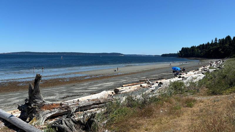
Extended warm, dry conditions have arrived on mid-Vancouver Island. Beaches such as Pipers Lagoon Park is one of many Nanaimo-area hotspots to cool off. (File photo/NanaimoNewsNOW)
hot streak

‘This ridge is noteworthy’: late summer heat blast strikes mid-Island

Aug 22, 2025 | 5:30 AM

NANAIMO — An extended stretch of hotter-than-average weather will appease those disappointed by recent interruptions of cloud cover and precipitation.

Environment Canada expects unseasonably warmer conditions for the mid-Vancouver Island region well into next week.

A daytime high of 30 degrees Celsius is expected on Friday, Aug. 22, followed by 32 degrees on Saturday, with more warm, dry conditions slated to persist, according to Environment Canada.

Meteorologist Matt Loney said a ridge of high pressure is blocking out clouds and elevating temperatures.

“This ridge is noteworthy somewhat for its strength, but in addition to its longevity. Seven to nine, possibly ten-day stretch where we’re going to see potential for daily records set most days, I would say, because we’re going to be in the low 30s.”

The daily temperature record for Friday, Aug 22 at the Nanaimo Airport is 31.1 degrees (1942), followed by 32.3 degrees on Saturday (1966).

Loney said the mid-Island’s forecast is bordering close to heat warning territory, triggered by consecutive days of at least 29 degrees Celsius and overnight lows of 16 degrees or warmer.

He said longer nights help to balance the hot days.

“Our nights are lengthening, so the temperature can recover a little bit, the humidity comes up at night.”

Loney recommends people seek shade and air-conditioned environments, if possible, for the next several days and stay hydrated.

The wildfire danger threat in the mid-Island region is bordering between moderate to high heading into the second-to-last weekend before a new school year starts.

While July was hotter and drier than usual, August has been an outlier regionally weather-wise, Loney noted.

More cloud cover and rain than usual have appeared above the mid-Island region so far this month.

“We’d get two or three day stretches of dryness and then it would be all be interrupted again by an upper trough. We had a number of them swing through this summer, which has made it a little bit different, it’s not unprecedented.”

According to Loney, nearly 36 millimetres of rain has fallen so far this month at Nanaimo Airport, beyond the normal amount of nearly 29 millimetres.

Aug 4, 13 and 14 contributed “big spikes” to rainfall totals this month in the Nanaimo area, Loney noted.

Subscribe to our daily news wrap. Local news delivered to your email inbox every evening. Stay up to date on everything Nanaimo and Oceanside.

info@nanaimonewsnow.com

Follow us on: Twitter (X) | Bluesky | Facebook