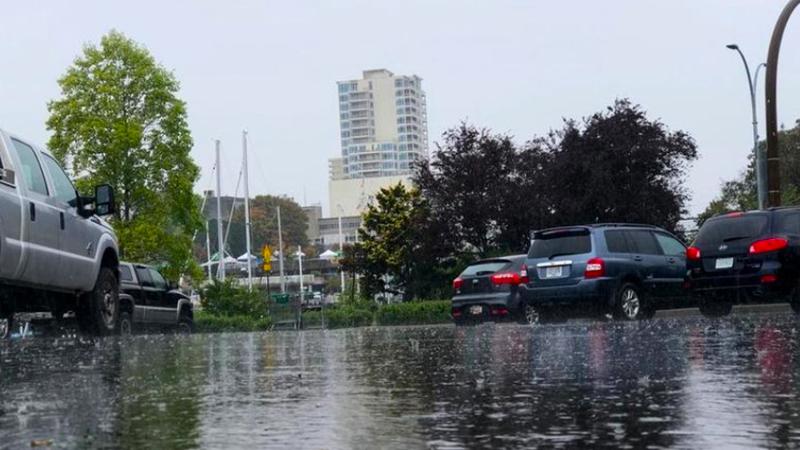
A pair of atmospheric river events last month was enough to drop a higher-than-normal amount of rain over much of eastern Vancouver Island. (File photo/NanaimoNewsNOW))
wet March

March storms drop plenty of rain across mid-Island

Apr 2, 2025 | 1:04 PM

NANAIMO — A pair of rain storms last month was enough to produce the 14th wettest March in 60 years.

That’s according to Environment Canada meteorologist Chris Doyle, who said 150.4 millimetres of rain fell in Nanaimo last month, about 140 per cent of the regular monthly average.

Two atmospheric river events played a big part in those numbers, with the east coast of Vancouver Island really getting “it on the chin rain-wise” last month.

“Those two events were probably responsible for really keeping all of the inner-south coast, and that includes all of the east coast of Vancouver Island, wetter than usual in March, just those two good systems that came through.”

Doyle said the situation was similar across much of the Island, with Comox receiving 158 per cent of the communities’ average rainfall, and Campbell River seeing 146 per cent.

Last month saw temperatures on par with average for the Harbour City.

“Temperture-wise, it was pretty close to average. The normal mean temperature for March is 6.3 (degrees Celsius)….the mean temperature in this case was 6.8, so about half a degree Celsius above average.”

The start of spring allowed Doyle to look back at their “meteorological winter”, categorized as December through February.

This past winter regionally was on the drier side, while the temperature worked out to be average for what the area typically sees, Doyle told NanaimoNewsNOW.

“The total precipitation measured during those three months at the Nanaimo Airport was 427.4 millimetres, normal is 524.7, so it was 81.5 per cent of normal precipitation.”

Looking into April, Doyle said it’s expected to start with a dry stretch while a “weak frontal system” which brought rain overnight Tuesday tapering off by Wednesday afternoon, with dry and warm conditions expected until Sunday.

But, that should change late in the day Sunday into Monday morning.

“We go back into a trough coming in off the Pacific, so it’ll get showery and wet and a bit breezy as well. We’re kind of looking at a risk of maybe the odd thunderstorm late on Sunday as this next front comes through and encounters all the warm air that’s left over from the weekend. Kind of like last week when we had a few sparks in the sky fairly nearby.”

Local news. Delivered. Free. Subscribe to our daily news wrap and get our top local stories delivered to your email inbox every evening.

info@nanaimonewsnow.com

Follow us on: Twitter (X) | Bluesky | Facebook