STAY CONNECTED: Have the stories that matter most delivered every night to your email inbox. Subscribe to our daily local news wrap.
A high-pressure weather system is settling over B.C. starting Tuesday, May 7 is expected to bring warmer than average temperatures province-wide, with the system expected to move west by Sunday. (File photo/NanaimoNewsNOW)
turning up the heat

High-pressure system bringing May heat wave to Nanaimo & Oceanside

May 7, 2024 | 9:56 AM

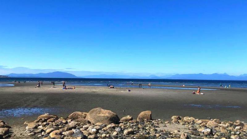
NANAIMO — Break out the sunscreen and board shorts as summer-like weather conditions are coming to the mid-Island this week.

Environment Canada is predicting a slow-moving high-pressure system will begin to settle over much of the province starting Tuesday, May 7, and continuing well into the weekend, bringing with it clear skies and higher-than-normal temperatures.

Meteorologist Armel Castellan said day-time temperatures are expected to be in the early 20’s by Thursday, with overnight temperatures hovering around 10 degrees celsius mid-week.

“Inland sections of the island and near the water will probably be a little bit cooler, closer to the lower 20s. Eventually, it’s going to kind of wane into the prairies and we’re going to see that high-pressure kind of slowly come off and we’ll see the clouds come back probably late in the weekend.”

The expected temperature for Friday, May 10 is 23 degrees, a full six degrees above average according to Environment Canada, and just shy of a record.

However, Castellan doesn’t think it’ll get as hot as it did this time last year, when the first big heatwave had some places on Vancouver Island reach 30 degrees.

He said while temperatures have been slowly increasing in the last few days, it doesn’t mean the mid-Island is poised to break any daily heat records.

“The trend in the forecast has been towards warmer, it’s been trending warmer over the last couple of days. So if that trend continues, and we bump up those numbers to maybe into the upper 20s, there is a chance that we’ll see a record or two fall somewhere on the south coast, maybe even into the interior but I think we’re at this point we’re shy of that.”

He said we’ll likely see high-pressure systems bringing warm and dry conditions to the area throughout the summer months, with a high probability of a warmer-than-average May, June, and July.

While this week’s high-pressure system should dissipate by the end of the weekend, Castellan said it’s still a good idea to keep your vulnerable friends and neighbours in mind.

“If they’re living in conditions where there’s very little insulation and their indoor air temperatures also creep up, it’s a great time to reach out to that population group and help them out and just remind them that hydration is important.”

Join the conversation. Submit your letter to NanaimoNewsNOW and be included on The Water Cooler, our letters to the editor feature.

jordan@nanaimonewsnow.com

On Twitter: @JordanDHeyNow